

This blog post starts a series in which we will be sharing a crazy summer of travel — most of it for spending time in nature and/or with people we love. Self-care is essential and time in nature is one of our healing modalities.
Our spring is quickly moving into the summer of getaways and travel! Here’s hoping your spring is treating you well — and we hope these blog posts inspire you to get out in nature and/or travel!
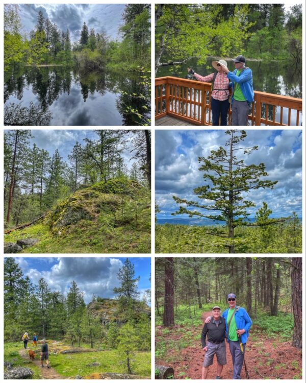
We start this post with a fun day hike to the Dishman Hills Natural Resources Conservation Area, a 530-acre park that consists of small ravines, hills, ponds, and large chunks of granite… located just south of downtown Spokane.
We can thank the Missoula Floods for the deep gullies that make for adventurous hiking! And those amazing granite outcrops were originally formed 70 million years ago, by volcanic magma pushing up through the Earth’s crust and then cooling. The park represents one of the most ecologically diverse regions in Washington state, where forests, grasslands, and shrublands converge.
Wildlife using the park include coyotes, weasels, squirrels, chipmunks, marmots, porcupines, cottontail rabbits, and white-tailed deer.
Interestingly, the park is jointly managed by three landowners, including the Washington Department of Natural Resources (DNR), Spokane County, and Dishman Hills Conservancy (DHC). Founded in 1966, the DHC is Washington State’s oldest Land Trust and a 501(c)(3) nonprofit organization.
We met up with our wonderful friends Jen and Roy, who live just down the block from Dishman, and set out on a plan to hike several of the trails, starting with the Pond Loop Trail (which has several little ponds to enjoy), then jumping onto the Pinecliff Trail, which then connects to the Nimbus Know Trail… which then connects back to the Pond Loop Trail. Lots of elevation changes, lots of spectacular outcrops, a few places with some excellent vistas, and many places with rocks in the trail — but all aspects are quite wonderful. Other trails we did not hike include the Deep Ravine Trail on the east side of the park and the Goldback Loop Trail in the southeast section.
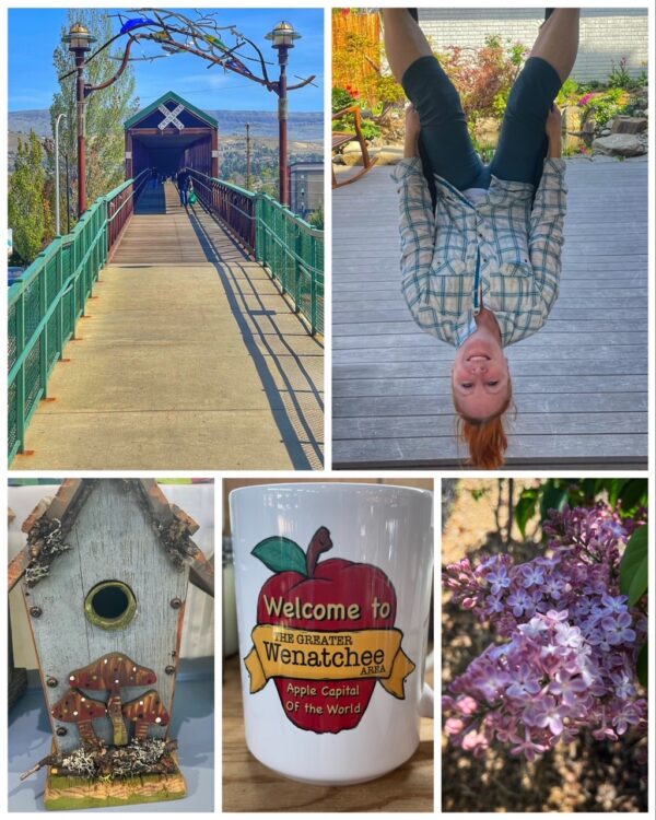
The previous weekend, we did a fun little getaway to Wenatchee, WA, located in the north-central part of the state, at the confluence of the Columbia and Wenatchee rivers, and known as the “Apple Capital of the World” because of the valley’s many orchards — most of which were in bloom on the weekend we visited! In fact, it was unseasonably warm and everything was greening up and blooming!
A friend has a cute Airbnb garage apartment located in the heart of the city, which we used as our headquarters for walking and exploring all the city has to offer. (It also has an inversion device, which Jen is using in the photo to the right, lol.)
Saturday morning was spent at Pybus Public Market, situated right along the Columbia River. We wandered through the plant sale and then visited with the merchants in the market.
Later that afternoon, we wandered through town, stopping to watch some of the Apple Blossom Festival Parade, which featured several marching bands. We also crossed the Railway Bridge and then walked along the Apple Capital Recreational Trail, a 10-mile, paved loop on both sides of the Columbia River, crossing the Wenatchee River twice.

On the way back home, we made two quick stops at places we love — and plan on exploring more in future getaways: Soap Lake and Dry Falls State Park.
Soap Lake is both a lake and a town, but the lake is much more interesting! Also formed by the Missoula Floods, the lake gets its name from the naturally occurring foam that gives the water a soapy appearance — and because the lake’s mineral-rich waters have a slick, soapy feel. There are 23 different minerals in the water! This meromictic soda lake is approximately 2 square miles in area and 70 feet deep.
The lake is the southernmost in a string of lakes in the Grand Coulee Valley caused by the flooding. Other lakes include Lenore Lake, Alkali Lake, Blue Lake, Park Lake, and Deep Lake. There are also some amazing caves to explore — the Lenore Caves — which we hope to do on our next visit to the area.
While we call it Dry Falls State Park, the official name is Sun Lakes-Dry Falls State Park… and it is a must-see stop when traveling this amazing geological corridor.
When you stop at the visitor center, you will be standing on a bluff overlooking the incredible Dry Falls — which were carved by Ice Age floods more than 13,000 years ago. This former waterfall was four times the size of Niagara Falls. Today, what’s left is the 400-foot-high, 3.5-mile-wide cliff… and the gorge and lakes created from that flood.
The Coulee Corridor will eventually lead you to the Grand Coulee Dam, an engineering feat worth seeing.
Next up? A birthday getaway for Ran.